


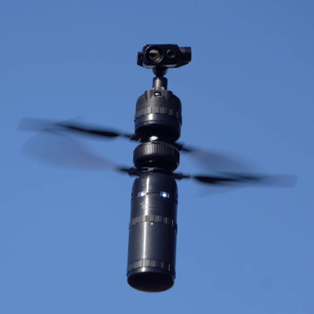
Ascent Spirit - The Ideal Platform for Mission Critical Operations
With nearly ten pounds available for batteries and payloads, Spirit sets the new standard for performance in its weight class. The highly streamlined airframe has a top speed of over 60 miles per hour and can operate in winds that would ground other UAVs. Enterprise level operations require solutions that are practical in the field.
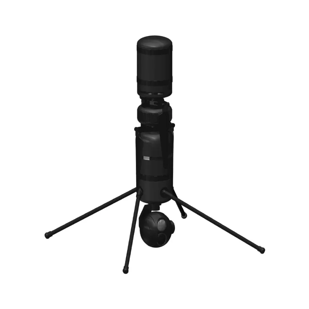
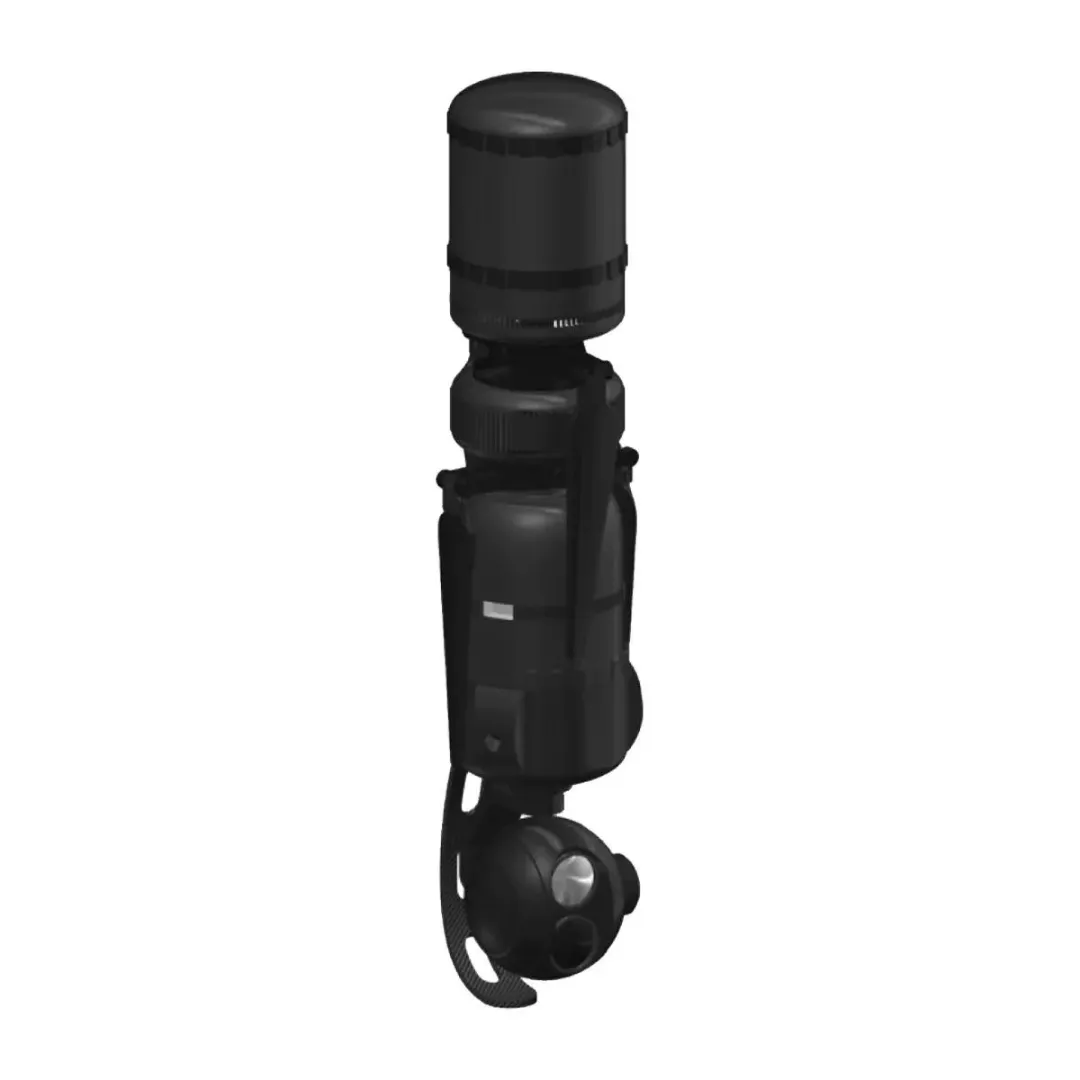
Compact & Modular
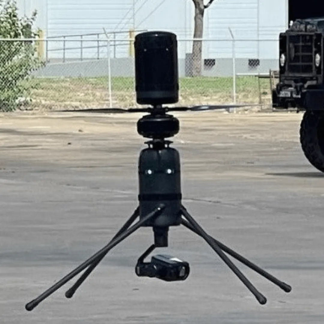
Spirit is compact and modular to support a growing ecosystem of easily swappable payloads and technology upgrades so it’s easy to bring what’s needed, where it’s needed, when it’s needed. No more high-stakes tradeoffs that compromise capability against bulky, heavy equipment. Setup is quick and easy, allowing for takeoff from any type of terrain.
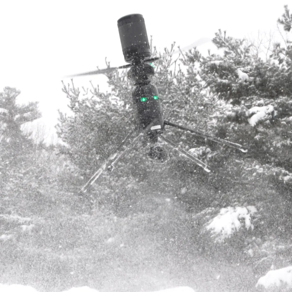
Rugged & All Weather
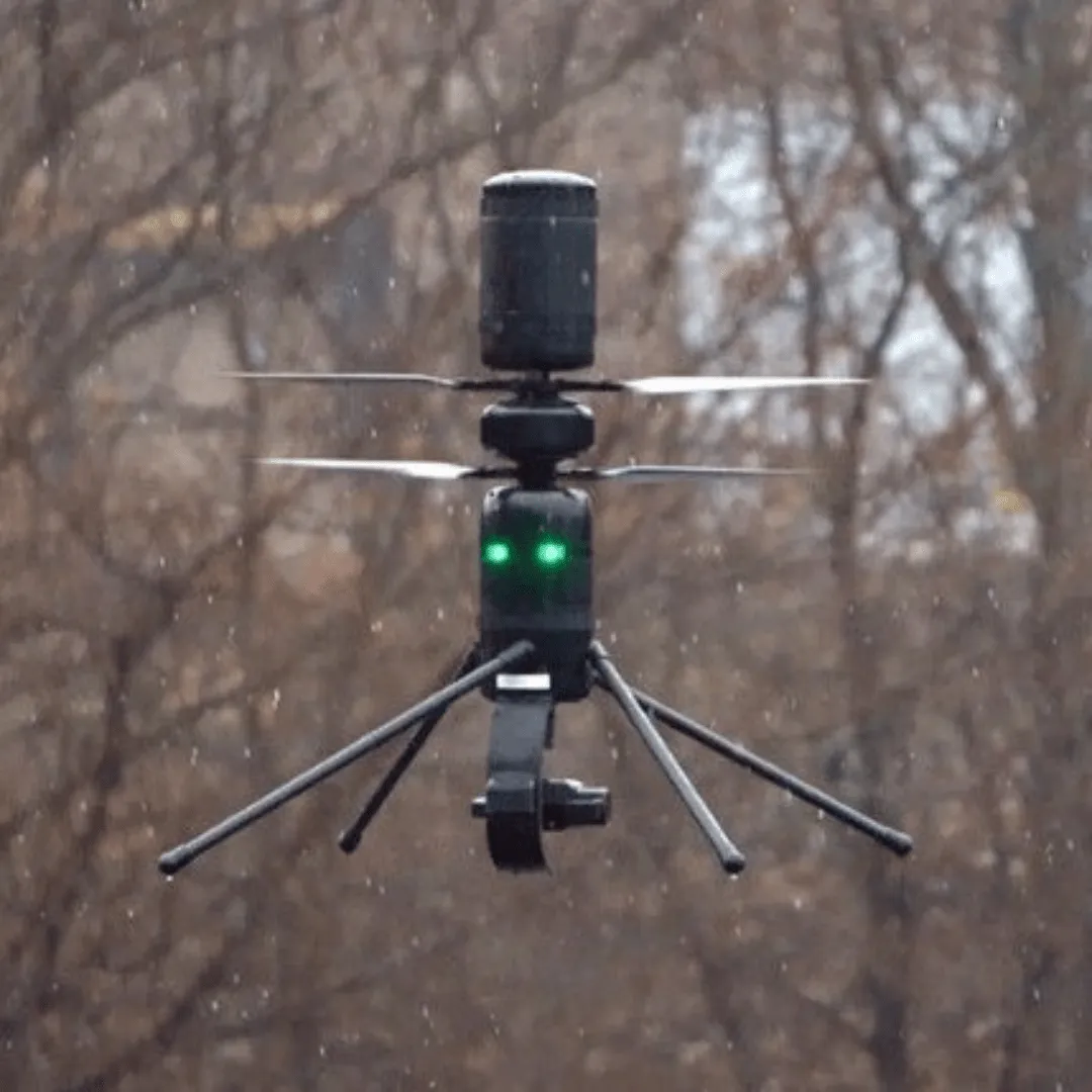
Spirit is protected against contamination and can reliably operate in adverse weather conditions, including heavy rain, sleet, sand and snow, and can operate in winds that would ground other UAVs.
Efficient & High-Performance
Spirit sets the new standard for performance in its weight class with nearly 10 lbs. available for batteries and payloads. The highly streamlined airframe has a top speed of over 60mph to go farther, faster, longer, and carry more.
Versatile & Adaptable
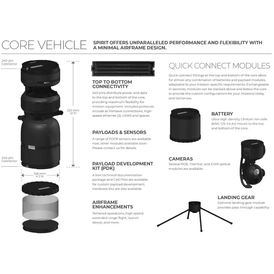
Spirit’s adaptable design avails entirely new deployment methods and allows operators to easily incorporate a growing ecosystem of swappable payloads and software. Top to bottom quick-attach fittings payloads and batteries that can be mounted or stacked on either point modules lock and unlock with a simple twist generous CG envelope accommodates a wide range of configurations.
Ascent Spirit - Compact, Rugged, and Efficient
Applications
Government - Rapidly deployable, rugged & efficient UAV for mission critical operations
- Intelligence, Surveillance, and Reconnaissance
- Precision delivery
- Communications relay
- Target identification and designation
Public Safety - Reliable response in any environment
- Search & rescue operations
- Law enforcement
- Rural firefighting
- Disaster response
Industrial - Coaxial system designed for quick & dependable deployment in extreme conditions
- Security
- Inspection
- Incident response
- Precision delivery
Specifications
SPECIFICATIONS & PERFORMANCE
| TYPE & CONSTRUCTION | Coaxial Unmanned Aerial Vehicle. Polycarbonates, composites, aluminum |
| AVAILABLE PAYLOAD MOUNTS | Top and bottom mounts can accept wide combination of batteries or payload (stackable) |
DIMENSIONS (NO BATTERY OR PAYLOAD) | 1. 12.0 inches (257mm) x 4.2 inches (106mm) (Other payload diameters are supported) 2. Tip-to-tip diameter w/blades extended 25.5 inches (650mm) |
| DRIVE SYSTEM | Direct drive with 2x brushless motors |
| MAXIMUM TAKEOFF WEIGHT | 13.5 lbs (6.1 kg) |
| EMPTY WEIGHT | Core Vehicle (no battery or payload) 4.0 lbs. (1.8 kg) |
| SYSTEM VOLTAGE | 12S 44.4 volts |
| BATTERY OPTIONS | • Single (6.0 A h) Double (2x 6.0 A h) • Battery weight 3.0 lbs. (1.4 kg) 6.0 lbs. (2.7 kg) • Maximum available payload 6.5 lbs. (3.0 kg) 3.5 lbs. (1.6 kg) |
| FLIGHT ENDURANCE | One Battery: 38 min with no payload / 16 min w/max payload Two Batteries: 53 min with no payload / 32 min w/max payload |
| ENVIRONMENTAL | Max Density Altitude: 14,600 feet above MSL (5,000m) Operating Temp: -40 to 130F (-40 to 54C) |
| ENVIRONMENTAL RATING | IP56 |
| MAXIMUM FORWARD AIRSPEED* | Max (manual mode): >60 mph (100 kph, 27 m/s) Auto (Recommended): 40 mph (65 kph, 18 m/s) |
| MAXIMUM RECOMMENDED WIND | Recommended 40 mph (65 kph, 18 m/s) or operator’s discretion |
STANDARD AUTOPILOT & NAVIGATION (Other Options Available)
| STANDARD AUTOPILOT | • Pixhawk 2 (Cube) Ardupilot/MAVLink. Commercial specifications standard, Domestic & MIL-spec available. • Other autopilots and encrypted communications standards are available |
| GUIDANCE SENSORS | Redundant sensors (barometer, compass, accelerometers, gyroscope) |
| SATELLITE | GPS, GLONASS |
| GROUND CONTROL STATION | • Integrated manual mode 2-stick control, autonomous navigation w/integrated 1920 x 1080 touchscreen LCD • Alternative options include ruggedized Windows PCs, Android, iOS available |
| COMPATIBLE GCS SOFTWARE | All Windows, Android and iOS versions of Mission Planner, QGroundControl, Tower, U.S. DoD ATAK |
STANDARD WIRELESS COMMUNICATION & VIDEO (Other Options Available)
| MANUAL FLIGHT CONTROL FREQUENCY | 2.4GHz Range: 12 miles (20 km) FCC; 7 miles (12 km) CE & SRRC |
| VIDEO LINK | 1080p @60/30 fps, 720p @30 fps. Latency <110ms from input source to GCS display |
| AIRBORNE VIDEO INPUTS | Dual HDMI inputs support simultaneous use of two airborne sensors |
BLUE SUAS COMPATIBILITY
| AIR VEHICLE | NDAA and Executive Order 13981-compliant |
| GROUND CONTROL STATION | Compatible with multiple Blue sUAS-approved GCS |
| SENSORS | NDAA-compliant sensors available |


![Apple Watch SE (2nd Gen) [GPS Cellular 44mm] Smart Watch w/Midnight Aluminum Case & Midnight Sport Band - M/L.](https://www.pathzx.shop/image/apple-watch-se-2nd-gen-gps-cellular-44mm-smart-watch-wmidnight-aluminum-case-amp-midnight-sport-band-ml_elWZva_300x.webp "Apple Watch SE (2nd Gen) [GPS Cellular 44mm] Smart Watch w/Midnight Aluminum Case & Midnight Sport Band - M/L.")


 Stealth Angel Survival")


